
The Ministry of Water & Irrigation is rolling out a Water Availability and Demand (WAD) tool dashboard to guide decisions on how the country allocates & stores its increasingly scarce water resources.
Irrigation Principal Secretary Ephantus Kimani said the digital dashboard will consolidate data on rainfall, groundwater levels, crop water needs, and irrigation demand to show where water exists, where it is lacking, and where storage infrastructure, such as dams, could have the biggest impact.
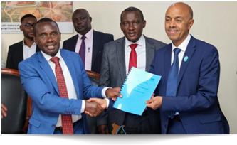
“As we abstract water, we must do it sustainably. This tool will show both availability and demand,” he said, during the handover of the tool developed by the International Water Management Institute (IWMI) and the Food and Agriculture Organization (FAO).
Kimani noted that poor planning often results in over-designed dams that do not match the water available in a basin. “When we design our dams, this tool is going to help us design appropriate dams and get value for money. It prevents scenarios where infrastructure is too big compared to the water available,” he said.
He added that the dashboard could also unlock private investment in irrigation projects by giving investors clarity on water availability and returns. “Investors need certainty to recover their money through irrigation tariffs. Knowing the volumes available helps inform tariffs and return on investment,” Kimani said.
According to the National Irrigation Authority (NIA) Chief Executive Officer, Eng. Charles Muasya, Kenya’s water scarcity makes it critical to allocate water more efficiently. “Irrigation is the largest consumer of freshwater in Kenya, almost 85 percent. Only 15 percent remains for domestic and other uses,” he said, noting that the WAD tool will help design dams and water parks that match real hydrological conditions.
FAO’s Assistant Country Representative for Programs, Hamisi Williams, said the tool is timely for evidence-based resource allocation as competition for water intensifies. “Resources are becoming scarce and decisions are getting tougher. To put resources where they’re needed and to use less to produce more, we need precision,” he said.
IWMI’s Regional Representative for East Africa, Abdulkarim Seid, said the tool blends satellite data with field information to monitor both supply and demand at county and basin levels. “This tool helps identify suitable locations for water storage, estimate storage needs for various crops, and calculate crop water requirements,” he said. “The tool has now been handed over to NIA to be used operationally in Kenya and potentially adapted for other countries in the Global South.”