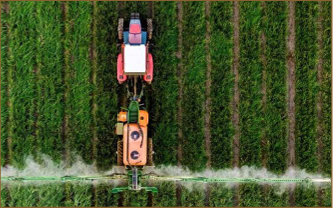

Spain’s irrigation sector has undergone significant transformation through investments in modern infrastructure, including pumping stations and pressurised distribution networks. However, infrastructure alone does not guarantee efficiency. A new challenge is emerging: ensuring water is applied in the right place, at the right time, and in the right quantity. Traditionally, irrigation decisions have relied on experience and established practices. While effective to a degree, this approach can lead to inefficiencies, particularly in a context of increasing water scarcity, rising energy costs, and growing environmental pressure. New technologies are enabling a shift…
Read MoreTag: agricultural water management
More than half of data centers face drought or flood risk, report finds
The ten highest-risk markets include Northern Virginia, the Carolinas, Atlanta, Johor, Singapore, Batam, Marseille, Bangkok, Beijing, and New York/Northern Jersey. Lowest-risk markets cluster in northern Europe (Stockholm, London, Copenhagen, Amsterdam, Oslo, Dublin) plus Toronto, San Francisco, Montreal/Quebec & Bogota. The industry is concentrating capacity in demanding locations rather than favorable ones. 30–50 percent of 2026 projects face delay as established hubs hit power, land & permitting constraints. The central argument: climate risk is underpriced. Markets with comparable power costs and demand are underwritten as equivalent despite materially different risk profiles,…
Read MoreA Satellite Watching Over Haryana’s Farms Is Helping the State Save Rs 300 Crore Per Year
Haryana received the Geospatial Excellence Award at the Geospatial World Forum in Amsterdam in May 2026 for a satellite-powered system that helps farmers identify water stress before they see it. The international jury praised Haryana’s Space Applications Centre (HARSAC) for building a practical, scalable system that tackles food security, environmental sustainability, and climate resilience together. At its heart, the platform brings together satellite imagery, remote sensing data, GIS dashboards, mobile apps, UAV surveys, and AI analytics in one operational layer. Through this, HARSAC provides crop monitoring and yield assessment, water…
Read More